Express Cycle Ways
Click below to see Cycling the Missing Link, a video record of cycling alongside the TEL from Bayfair to Papamoa Eastern Interchange. Very easy and possible to do. Just add a couple of overbridges over the major roads.
Tauranga - Bayfair - Papamoa East - Te Puke
The future transportation solution is multimodal, some will drive, some will bus, some will bike, scooter and some will walk. You will pick which is best for you. The future is here NOW!
In Tauranga there are not these options for everyone and there are no express cycleways from Papamoa to anywhere. Papamoa is flat and suitable for express cycleways, especially with the growing numbers of e-bikes.
Cycling between Papamoa and Bayfair on the incomplete and mismatch of TCC cycleways is very dangerous and very slow. This discourages commuter cycling.
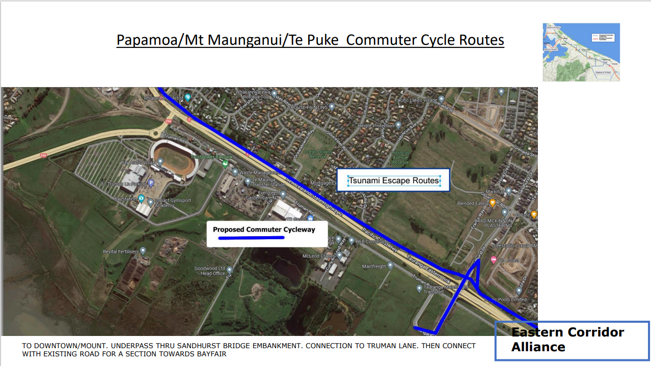
This is a proposal for a network of express cycleways, mostly it uses land which is readily available on the grassed areas alongside the Tauranga Eastern Link expressway.and travels in the most direct route.
A cycleway which will be independent of the major roads.
Not on the sides of the road. Completely separate. Safe.
No lanes taken away from roads.
Travel times will be faster, less stopping at road intersections.
Distances are within easy range of E bikes
Link with existing tsunami evacuation paths for pedestrians and cyclists
Easy access to/from Papamoa residential areas.
Connectivity with the existing TSUNAMI EVACUATION routes. Click for more details
Now all we need is the will from the government, council and community, and of course some finance.
The express cycle routes are between
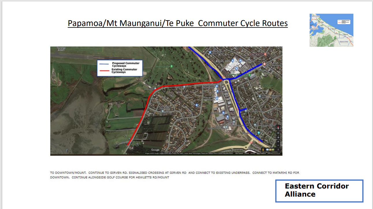
Papamoa to Mt Maunganui
Papamoa to Te Puke
Papamoa to Downtown Tauranga
Detailed Design and Requirements of the Commuter Cycleways: Download pdf file summary
Te Puke to Papamoa East Interchange towards Parton Rd
Parton Rd overbridge
Parton Rd to Domain Rd
Past Papamoa parallel to Gravatt Rd
Towards Baypark past Bruce Rd and new BP petrol station
Past Sandhurst Rd overbridge to Baypark
Continue through to Bayfair, cross highway using Underpass.
Continue to Hewletts Rd area by new cycleway around golf club and airport perimeter.
New PEI bridge needs pedestrian and cycle paths linking directly to Bell Rd for connectivity with Te Puke and provide a Tsunami evacuation route from The Sands area. Sketch below shows base plan with RED path added.
From Tauranga Cycle Plan document NZTA to invvestigate a cycleway alongside the TEL from Bayfair to Domain Rd. Was this done?


